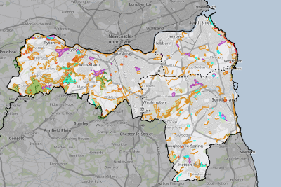
Map of areas of particular importance for biodiversity

The map shows:
- The boundary of the South of Tyne and Wear Local Nature Recovery Strategy area, the local authority boundaries of Gateshead, South Tyneside and Sunderland, and the neighbouring boundaries of North of Tyne; Durham; and Tees Valley Local Nature Recovery Strategies.
- The boundaries of international, national and local designated nature conservation and geological sites within the South of Tyne and Wear Local Nature Recovery Strategy area. Click on any designated site to see its name, status (designation) and a brief description.
- The boundaries of Irreplaceable Habitats occurring within the South of Tyne and Wear Local Nature Recovery Strategy area. View more information about irreplaceable habitats on the Gov.uk website (opens new window).
Each of the above boundaries can be selected/de-selected using the dropdown menu on the righthand side of the map.
The Legend is shown on the left hand side of the map.
Simply zoom in and out and scroll around the map using your mouse, keypad or fingers; and switch between the basemap and aerial photography layers by clicking on the imagine in the bottom left of the screen.
View a larger version of the map (opens new window)


